The Upper Valley is home to beautiful hiking right out the back door. For those looking for bigger hikes into the alpine zone, there is plenty of terrain within a two-hour drive. Hiking in New Hampshire is very different than in other parts of the country, however; it is rocky, technical terrain. Often the vertical in the hike is reached in the last few miles—and you can bet no White Mountain trail-cutter ever bothered with switchbacks. Read on for a list of hikes of varying difficulty!
Gile Mountain (Easy)
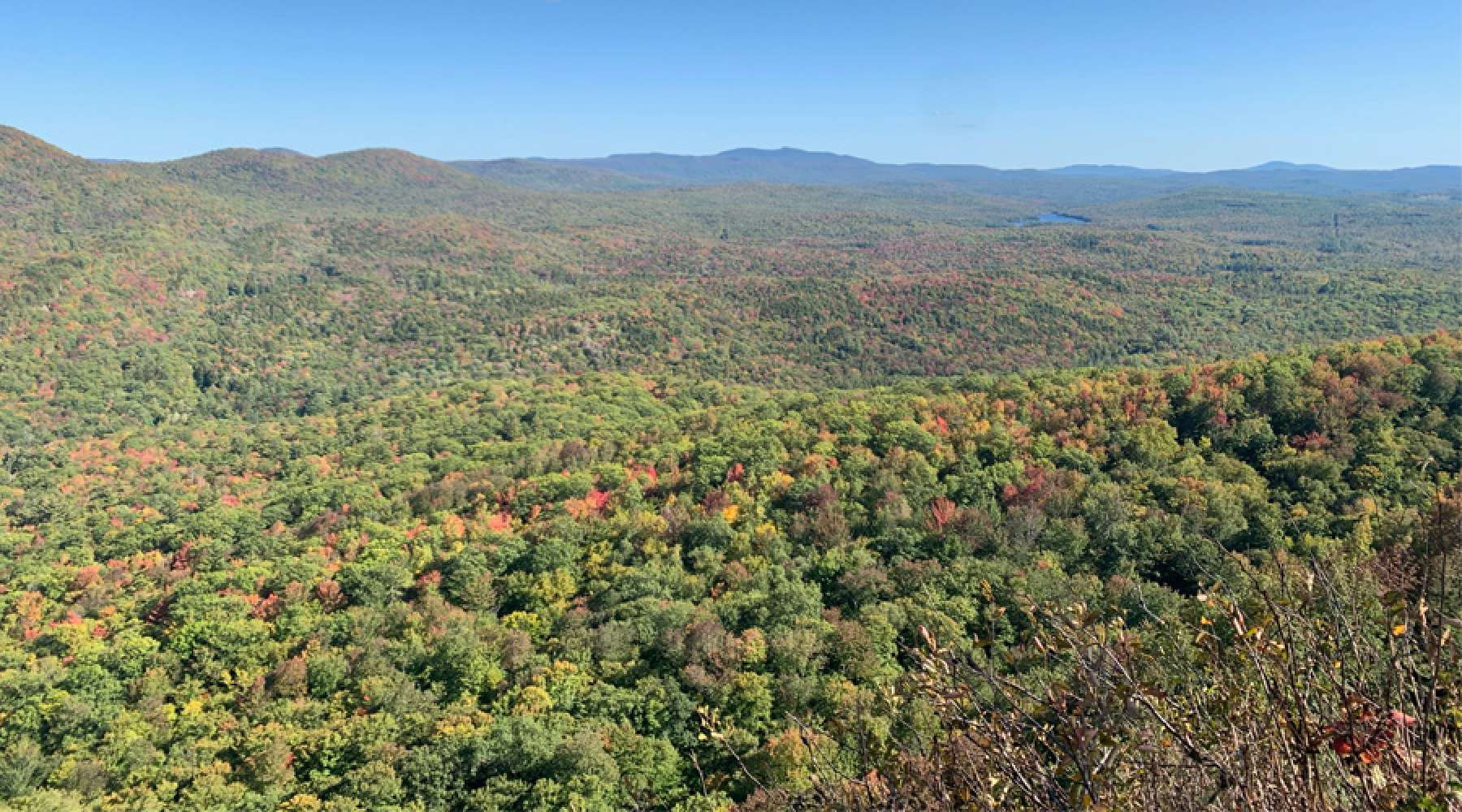
Located 20 minutes from Tuck’s campus, Gile mountain is a well-maintained 1.4 mile hike up to a fire tower that has beautiful views of the Upper Valley. Great for a sunrise or a sunset, this hike is incredible during peak foliage weekend (10/9).
Holt’s Ledge (Easy)
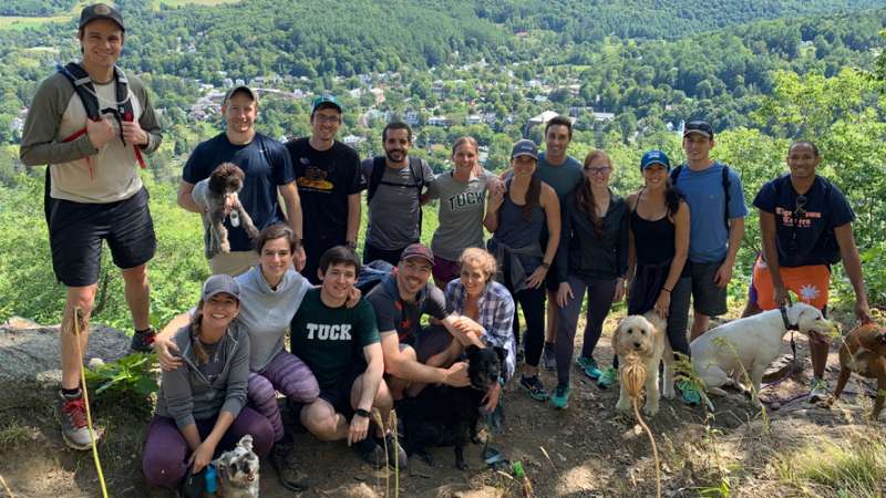
25 minutes North along route 10 sits the Dartmouth Skiway, a small but steep mountain with views towards Eastern NH. At 3.4 miles, this trail is a quick summit. The trail is well-maintained with a great lunch spot at the top of the chairlift. (Photo, top)
Smarts Mountain (Intermediate)
Part of the Appalachian Trail, Smarts is a great mountain for those looking to add more mileage and build up to steeper peaks. While the trail is mostly in the trees, the 3.5 mile ascent takes the hiker passed viewpoints that look out to Dorchester and Holt’s Ledge and finally to a fire tower with panoramic views of the Green and White mountains. At 7 miles total, this is a great day hike without having to drive far.
Sunset on Giles Mountain. Photo by Seamore Zhu, Dartmouth College.
Mount Moosilauke (Intermediate)
Just over an hour from campus, this 9 mile hike is a good introduction to steep terrain. The trail is well maintained by the Dartmouth Outing Club and boasts beautiful views of the White Mountains from the top. Get an early start on weekends as the parking lot by the Mossilauke Ravine Lodge tends to fill up quickly. Take the Gorge Brook Trail up and the Carriage Road to Snapper Trail down.
Mount Osceola and East Osceola (Hard)
In this hike it becomes apparent how little New Hampshire natives like switchbacks. Parts of it are straight up with massive boulders and a section referred to as “the Chimney.” Well worth the huffing and puffing, the second summit consists of a sunny, flat ledge perfect for that trail PB&J with great views of Mount Carrigan and Mount Washington. On the way down, stop by the Greely Ponds for a refreshing (NH term for bone-chilling) swim. Take the Greely Pond Trail to the Mt Osceola trail. This hike is 8.3 miles and about 90 minutes from campus.
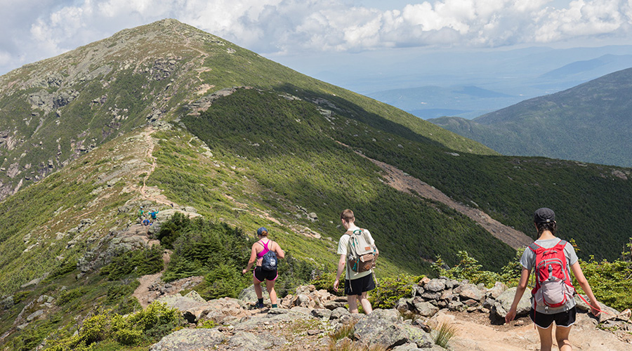
Hiking Franconia Ridge. Photo by Seamore Zhu, Dartmouth College.
Franconia Ridge (Hard)
A technical and steep hike, this loop starts at the Falling Waters trail, taking the hiker past numerous waterfalls and steeps before popping out onto Frankie Ridge. After a traverse with views to both sides and two more summits, the Bridal Path Trail descends past the Greenleaf Hut and back to the parking lot. Not for the faint of heart, this 8.6 mile loop has beautiful views of Franconia Notch and the Pemi Wilderness. Bring layers to the top of the ridge as weather can blow in quickly.
Presidential Traverse (Sufferfest)
One of the more technical point-to-points in NH, this trail starts with a steep ascent of Mount Madison. The trail bags Mount Adams, Jefferson, Washington, Monroe, Eisenhower, Pierce, and Jackson (bonus peak). Clocking in at about 20 miles, this trial covers over 9000 feet of vertical. The terrain is technical and exposed but has some of the most beautiful views in New Hampshire. Complete it in a day if you really want that pain cave.
Maria Mastanduno T’21 is an Upper Valley native and has spent many a summer playing in these mountains. Thanks to her understanding employer from this summer, she was able to complete the Presidential Traverse two times and summit Moosilauke 27 times. Her dog, Nori, does every hike with her. Both are powered by Cabot.
Create a profile to learn more about Tuck and receive news and updates